Desolation Sound & the BC Gulf Islands
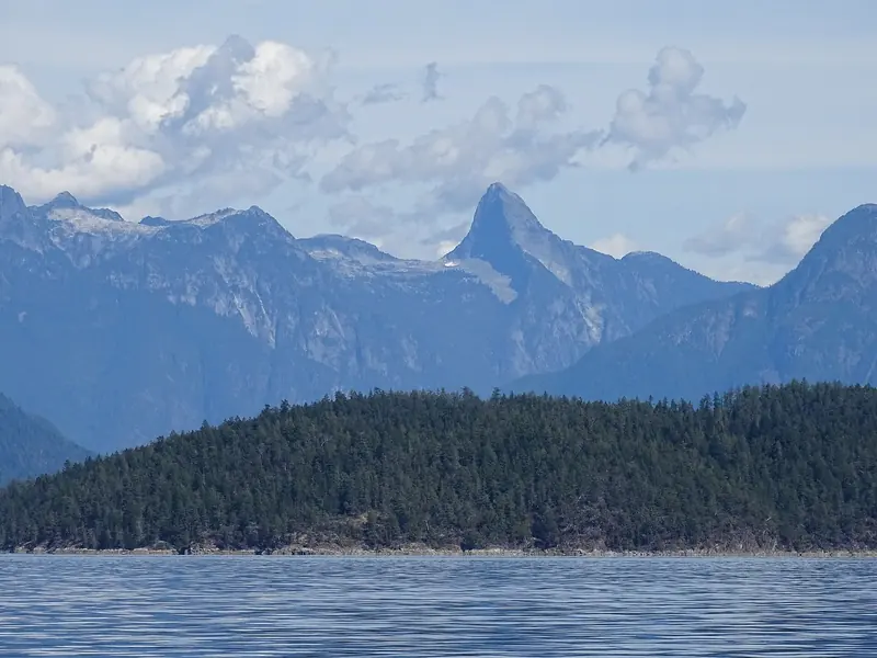
| Location | BC's east-Vancouver-Island and mainland coast running from the Gulf Islands north through the Discovery Islands to Desolation Sound, roughly 90 to 150 km north of Vancouver |
|---|---|
| Desolation Sound Marine Provincial Park covers 8,449 hectares, established 18 May 1973, the largest marine park in British Columbia | |
| Gulf Islands National Park Reserve, established 2003 and formally opened in 2010, protects 36 sq km of land across 16 islands plus more than 30 islets within 26 sq km of adjacent water | |
| Water temperature in Desolation Sound reaches 21 to 27C in summer; Pendrell Sound specifically hits about 79 to 80F, against a regional Pacific Northwest average of roughly 9 to 12C, per cruisers Jim and Lisa Favors, who checked their own thermometer twice in disbelief | |
| Distance | Vancouver's Coal Harbour to Sarah Point, the entrance to Desolation Sound, is 86 nautical miles by water; Lund, the last town on Highway 101, is about 90 miles north of Vancouver by road and two BC Ferries crossings, roughly 5 hours |
| The tidal gateway is Yuculta Rapids, Gillard Passage and Dent Rapids between the Discovery Islands and the mainland; using Gillard Passage as the reference station, Dent turns to flood 15 minutes and to ebb 25 minutes before Gillard, and Yuculta turns 25 minutes after flood and 5 minutes after ebb | |
| CBSA clearance for a pleasure craft means reporting to a marine reporting site and phoning the Telephone Reporting Centre at 1-888-226-7277; only the captain may leave the boat before clearance, and there is no Canadian equivalent of the US CBP ROAM self-report app for pleasure craft | |
| Killer whale approach distance in Canadian Pacific waters is 200 metres by default under the Marine Mammal Regulations; Fisheries and Oceans Canada has an interim 1,000 metre rule for endangered Southern Resident killer whales in effect between Campbell River and just north of Ucluelet | |
| Grizzly and black bear sightings in the fjords north of Desolation Sound have risen since British Columbia's 2017 ban on grizzly trophy hunting, per Maple Leaf Adventures co-owner Maureen Gordon | |
| Refuge Cove General Store, founded in 1918 and rebuilt after a 1968 fire, operates seasonally June through September with about 2,000 feet of guest dock and a fuel dock selling gasoline, diesel and propane | |
| Port Sidney Marina charges 2.45 CAD per foot per night for transient moorage April through September (1.80 off season); it is a CBSA reporting site with a dedicated customs dock at the end of G dock, monitored on VHF 66A | |
| Prideaux Haven and nearby Tenedos Bay, the best-known anchorages, get genuinely crowded in July and August, with accounts documenting more than 80 boats anchored in Tenedos Bay in a single August; most boats stern-tie to shore pins because the anchorages are too deep to swing on a single hook | |
| Cell coverage is spotty through Desolation Sound and the Discovery Islands to the north, per multiple boater reports; steep-sided inlets block both cellular and VHF line of sight in places, and VHF weather broadcasts remain the more reliable source | |
| Pacific Yellowfin owner-operator Captain Colin Griffinson recommends September into October and May through early July over the July-August peak, for eagle numbers without the crowds | |
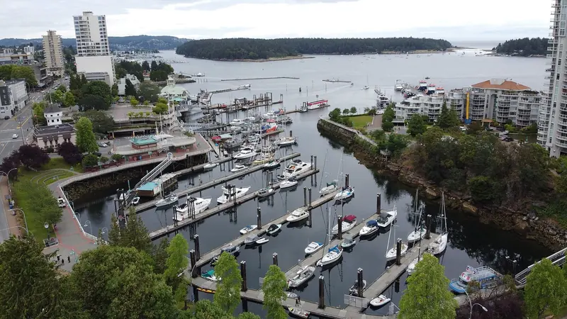
| Nanaimo's downtown boat basin sits inside the Nanaimo Port Authority harbour, itself a CBSA marine reporting site through Townsite Marina, and is the largest fuel and provisioning stop on Vancouver Island's east coast between Victoria and Campbell River | |
A Different Border, a Different British Columbia
The Gulf Islands proper are the roughly 200 islands scattered between Vancouver Island and the BC mainland, protected in part since 2003 as the Gulf Islands National Park Reserve, 36 sq km of land on 16 islands plus more than 30 islets. North of them, past Nanaimo and Campbell River, the Discovery Islands sit at the mouth of a set of genuine tidal rapids, and beyond those rapids the coast opens into Desolation Sound, 8,449 hectares of BC's largest marine park, established in 1973. It is one continuous cruising ground on paper, but it reads as three distinct legs: settled island cruising around Sidney and Nanaimo, a tidal gauntlet through the Discoveries, then wilderness.
The scale and the scenery are the difference from the San Juans. Maple Leaf Adventures co-owner Maureen Gordon describes Desolation Sound's landscape as dramatic, with the snow-peaked Coast Range rising straight out of the fjords, and calls it an alternative to BC's more distant and expensive Great Bear Rainforest. Indigenous peoples have used these waters for roughly 10,000 years, and Captain George Vancouver charted and named the Sound in 1792, reportedly finding the poor farming soil desolate even as the scenery impressed him. Nothing in the San Juans reaches that far north or that far into genuine wilderness.
The Warmest Salt Water North of Mexico
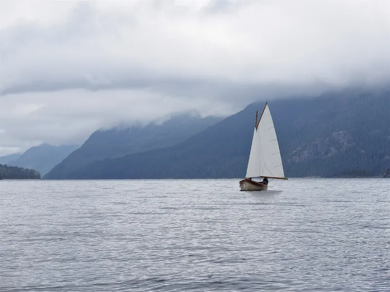
Pacific Yellowfin owner-operator Captain Colin Griffinson explains the mechanism in practical terms: at low tide, a Desolation Sound beach is full of food, because the water temperature lets mussels, mollusks and oysters thrive in a way they cannot further south or in the open Strait. Cruisers Jim and Lisa Favors anchored in Pendrell Sound specifically to test the claim, registered 79F on their own thermometer, checked it twice because they did not believe it, and noted that most of the rest of the Pacific Northwest's salt water runs a brisk 48 to 54F by comparison.
Blue Water Sailing writer Andrew Cross, cruising the Sound with his family, wrote that the warm waters so famously described were not exaggerated, and that they found themselves in and out of the water multiple times a day; leaving the region, he noted the water got noticeably colder and the crew missed the anchorages they had swum from just days before. For an owner used to the cold-water caution that governs most Pacific Northwest cruising, that is the single biggest difference this destination offers over its neighbours to the south.
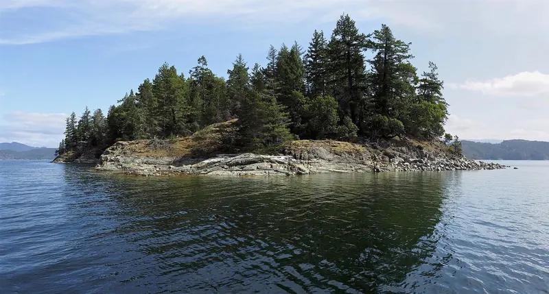
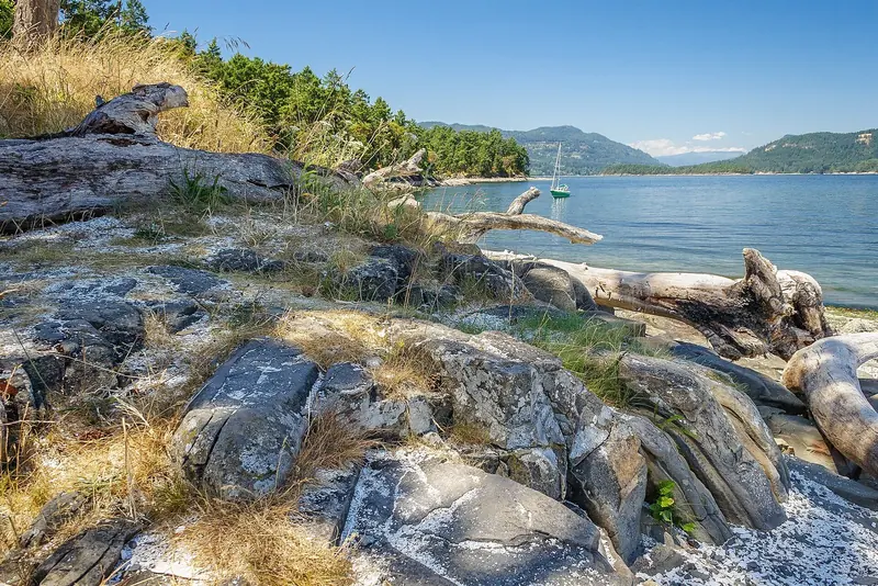
Pendrell Sound, inside Desolation Sound, reaches roughly 27C in summer, salt water warmer than anywhere else on the North American Pacific coast.
The Tidal Gauntlet Before Desolation Sound
The standard tactic, confirmed across multiple cruising accounts, is to arrive at Dent Rapids about 15 minutes ahead of slack at Gillard, transit Dent and Gillard together near their quietest window, then carry on through Yuculta at or close to slack. Done properly the whole chain takes 30 to 45 minutes; done at the wrong state of tide, particularly at Dent, the flows are not laminar and whirlpools, overfalls and boils can appear even within 15 minutes of slack.
Cruiser Peter Hayden, writing about his own transit, said the anticipation was the worst part of the trip: timing Dent for slack and reaching Yuculta 30 minutes early, then briefly worrying he had misjudged the current when it ran the wrong way before sweeping favourably through both passes. The consensus among BC cruising guides and forums is to work from the Canadian Hydrographic Service's Tide and Current Tables Volume 6 or the Ports and Passes annual, never to guess, and never to attempt the rapids at anything but a genuinely planned slack.
Clearing Into Canada by Water
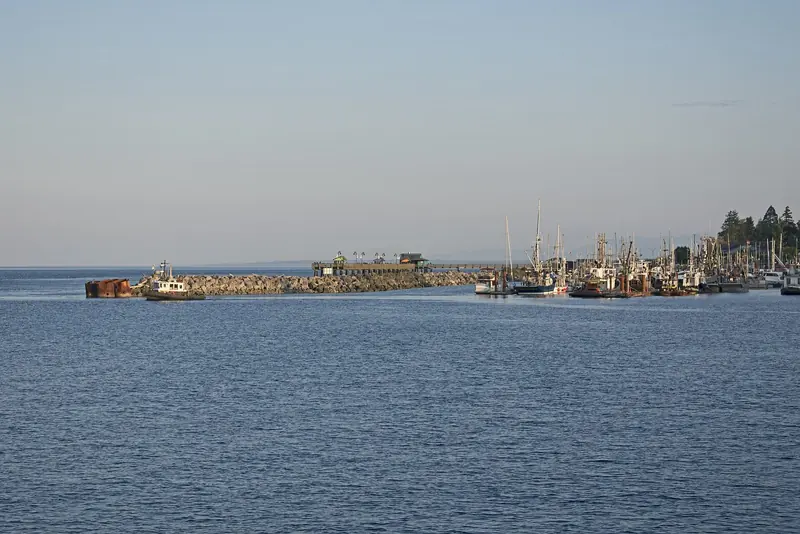
British Columbia carries around 17 marine reporting sites for this purpose, including Sidney's RVYC outstation and Port Sidney itself, Townsite Marina in Nanaimo, Bedwell Harbour on Pender Island, Ganges Harbour and Montague Harbour on Salt Spring and Galiano, and several yacht club outstations further into the Gulf Islands. Some, like Bedwell Harbour, operate seasonally and reopen for the season on a fixed spring date rather than year round, so a spring or shoulder-season arrival needs to check which site is actually staffed and open before planning a landfall there.
The discontinued Canpass-Private Boats program still lets holders of a valid, unexpired card use it until expiry, but the program stopped accepting new applications in 2018, so a first-time visitor should plan on the standard telephone report rather than assume a fast-track card is available. A NEXUS card speeds processing at land, air and marine ports generally but does not replace the marine reporting-site-plus-phone-call procedure itself. Note that a widely reported change to the CBSA's Remote Area Border Crossing permit, phased out through 2026, affects Great Lakes border crossings such as Lake of the Woods and Lake Superior, not this BC coast, so it does not change the procedure described here.
A Short Season, and How to Dodge the Crowd
Cruising accounts describe Tenedos Bay holding more than 80 anchored boats in a single August, and Prideaux Haven has a standing reputation as one of the most crowded anchorages on the entire BC coast in peak season, most of the boats arriving from the US side of the border. Grace Harbour, another favourite for its freshwater lake trail, is reported as usually far too crowded in midsummer but genuinely quiet by September. Guides consistently recommend carrying stern-tie line and shore pins as standard kit for this cruising ground, not an optional extra.
Pacific Yellowfin owner-operator Captain Colin Griffinson puts his own ideal cruising window at September into October and May through early July, citing one of the biggest bald eagle concentrations anywhere, largely unnoticed by the July-August crowd. That shoulder-season case is echoed by multiple cruising writers noting that September brings back both the wildlife and the empty anchorages the Sound is famous for, at the cost of cooler air and water than the height of summer.
Bears, Orcas and the Rules on the Water
Fisheries and Oceans Canada has proposed making the 1,000 metre Southern Resident distance permanent, but as of the interim order it applies specifically to that southern stretch of coast rather than the whole of BC, so a boater working north of Campbell River should still know both numbers rather than assume the stricter one always applies. The gap between Canada's approach here and Washington State's blanket 1,000 yard rule for the same whales in the San Juans is a real, sourced difference between the two sides of this inland sea.
On land, Maple Leaf Adventures co-owner Maureen Gordon reports that bear sightings in the fjords north of Desolation Sound have risen over the past decade, tying the change to British Columbia's 2017 ban on grizzly trophy hunting altering the animals' behaviour around people. Klahoose Wilderness Resort tourism manager Chris Tait frames the resulting experience as land-based bear viewing from platforms with Indigenous guides rather than a boat-side encounter, which is the safer and increasingly the standard way this coast now handles the growing bear population.
Nanaimo, Sidney, Pender Harbour and the Outposts Beyond
Nanaimo's downtown boat basin, inside the Nanaimo Port Authority harbour, is the largest fuel and provisioning stop on this stretch of coast, with Townsite Marina serving as the CBSA marine reporting site; Nanaimo Boat Basin and Stones Marina both take overnight guests. Sidney, closer to Victoria, centres on Port Sidney Marina, 320 slips taking boats up to 138 feet, transient moorage at 2.45 CAD per foot per night in summer, and a dedicated customs dock at the end of G dock monitored on VHF 66A. Further north, Pender Harbour and its Garden Bay anchorage carry yacht club outstations for Royal Vancouver and Seattle Yacht Club members alongside commercial marinas and a government dock at Madeira Park.
Beyond Pender Harbour the character changes: Lund, at the literal end of Highway 101, is the last fuel and provisioning stop before Desolation Sound, 86 nautical miles from Vancouver's Coal Harbour by water, with a fuel dock and a general store carrying groceries, a post office and a liquor agency. Inside the Sound itself, Refuge Cove's general store has operated since 1918 and still runs a seasonal fuel dock and roughly 2,000 feet of guest dock from June to September, while Squirrel Cove on Cortes Island offers a community dock and a general store selling fuel, groceries, hardware and shellfish licences. None of these keep winter hours comparable to a Sidney or a Nanaimo, so a shoulder-season cruiser should confirm what is actually open before counting on it.
A terra, accessi e prenotazioni
| Getting there | By water, Vancouver's Coal Harbour to Sarah Point (the entrance to Desolation Sound) is 86 nautical miles. By road and ferry, Lund, the jumping-off point, is about 90 miles north of Vancouver via two BC Ferries crossings, roughly 5 hours. Nanaimo, Comox and Campbell River all have airports for crew changes closer to the cruising ground. |
|---|---|
| Best season | July and August are warmest and busiest. Captain Colin Griffinson (Pacific Yellowfin) and multiple cruising writers recommend May through early July and September into October instead, for wildlife and empty anchorages at the cost of cooler air and water. |
| Tidal rapids timing | Yuculta Rapids, Gillard Passage and Dent Rapids must be transited near slack, referenced to Gillard Passage: arrive at Dent about 15 minutes before Gillard slack, transit Dent and Gillard together, then Yuculta shortly after. Use the CHS Tide and Current Tables Volume 6 or Ports and Passes; never guess. |
| Clearing Canadian customs | Dock at an approved CBSA marine reporting site (Port Sidney, Townsite Marina Nanaimo, Bedwell Harbour and others; some seasonal only) and have the captain alone phone the CBSA Telephone Reporting Centre, 1-888-226-7277. No passengers or goods may leave the boat until cleared. There is no Canadian self-report app equivalent to US CBP ROAM for pleasure craft. |
| Whale and bear rules | 200 metre minimum approach distance for killer whales under Canada's Marine Mammal Regulations, tightening to an interim 1,000 metres for Southern Resident killer whales between Campbell River and just north of Ucluelet. Bear encounters on this coast are increasingly handled as land-based, guided viewing (e.g. Klahoose Wilderness Resort) rather than close boat approach. |
| Moorage cost | Port Sidney Marina: 2.45 CAD per foot per night, April to September (1.80 CAD off season). Nanaimo Port Authority's current visitor rate per foot is not published on its public site; the marina asks boaters to call ahead. Refuge Cove and Squirrel Cove charge dock fees locally; exact current rates are not published online. |
| Fuel and provisioning | Nanaimo and Sidney are the full-service stops. North of Pender Harbour, Lund (fuel, general store, post office) is the last major provisioning point before Desolation Sound; inside the Sound, Refuge Cove and Squirrel Cove run seasonal (June to September) fuel docks and general stores. |
| What is not published | A current, single published fine schedule for whale-approach-distance violations in BC waters; and the Nanaimo Port Authority's own visitor moorage rate per foot, which the marina keeps off its public rates page and directs callers to confirm by phone. |
Cosa riferiscono armatori ed equipaggi
The best months to see wildlife without the crowd are the shoulder seasons, not midsummer
"My ideal times are September into October, and May through early July. We have one of the biggest bald eagle shows in the world then and nobody knows about it."
Captain Colin Griffinson, owner-operator, expedition yacht Pacific YellowfinBear numbers in the fjords north of Desolation Sound have visibly increased since BC banned grizzly trophy hunting
"Bears were being trophy-hunted in B.C., and now they're not, so their behavior has changed as well, and we see all these animals feeding in fall and spring."
Maureen Gordon, co-owner, Maple Leaf AdventuresThe warm water claim is not marketing exaggeration
"The warm waters that so famously fill the area were not exaggerated and we found ourselves in and out multiple times a day", noting the water grew noticeably colder on the way home and the crew missed the anchorages they had swum from days before.
Andrew Cross, cruising sailor, writing for Blue Water SailingTransiting the Yuculta-Dent-Gillard rapids is more about the wait than the water
"Anticipation was the worst part of the trip"; timing Dent for slack current and reaching Yaculta 30 minutes early, briefly second-guessing the plan when the current initially ran the wrong way before both passes cleared safely near slack.
Peter Hayden, cruiser, MV TanglewoodPendrell Sound's water temperature holds up to direct measurement, not just reputation
Anchored and swam without hesitating, then checked their own thermometer twice because a reading of 79F seemed too warm to be real, against a Pacific Northwest average of 48 to 54F.
Jim and Lisa Favors, cruisers, Trailer Trawler Life
Cosa convince e cosa va valutato
Punti di forza
- Genuinely warm water at this latitudePendrell Sound and much of Desolation Sound reach 21 to 27C in summer, independently measured by multiple cruisers, a real outlier for the Pacific Northwest and unmatched anywhere else on this coast.
- Scale and wilderness the San Juans cannot offerA continuous range of well over 150 nautical miles from settled Vancouver Island marinas to a fjord-and-mountain wilderness with grizzly and black bear populations visibly recovering since the 2017 trophy-hunting ban.
- Real working outposts instead of resort marinasRefuge Cove (trading since 1918) and Squirrel Cove still run as genuine general stores and community docks, not branded marina resorts, giving the cruising ground a character its more developed neighbours have largely lost.
- A well-documented tidal and navigational structureThe Yuculta-Dent-Gillard timing is precisely charted against a single reference station and repeatedly confirmed across independent cruising accounts, so a careful skipper can plan the passage with real confidence rather than guesswork.
Da valutare
- Peak season is genuinely overcrowdedPrideaux Haven and Tenedos Bay draw dozens of boats nightly in July and August, documented at over 80 in Tenedos Bay in a single count, forcing stern-ties in anchorages too deep to swing a single hook.
- The tidal rapids are a real hazard if mistimedDent Rapids in particular produces whirlpools, overfalls and boils within 15 minutes of slack water; this is not a current to underestimate or attempt without proper tide tables.
- Communications and support thin out fast north of Vancouver IslandCell coverage is reported as spotty through Desolation Sound and the Discovery Islands, steep-sided inlets block both cellular and VHF line of sight in places, and the seasonal outposts (Refuge Cove, Squirrel Cove) close or reduce hours outside June to September, leaving a shoulder-season cruiser more self-reliant than the marked marinas further south suggest.
- Canadian customs clearance has more friction than the US side of the same watersThere is no self-report app equivalent to CBP ROAM for pleasure craft entering Canada here; clearance is a phone call to a Telephone Reporting Centre from an approved reporting site, some of which operate seasonally only, which is a slower and less flexible process than the app-based US alternative.
A chi si rivolge: An owner who wants a genuinely wild, mountain-backed cruising ground with water warm enough to swim in, and who is willing to plan a passage around tidal rapids and a foreign customs clearance rather than just point the bow and go.