Saint Lucia and the Pitons
| Island size | about 27 miles north-south, 14 miles east-west, highest point Mount Gimie at roughly 950 m |
|---|---|
| IGY Rodney Bay Marina | 253 slip berths plus 32 fixed megayacht docks |
| Rodney Bay Marina max vessel size | 285 ft (86.8 m) LOA, 60 ft beam, about 13 ft draft |
| Rodney Bay Marina boatyard | 75-ton travel lift, 28 ft wide haul-out bay |
| Rodney Bay Marina has on-site customs, immigration and port health | |
| Reported transient dockage for a 42 ft monohull: roughly USD 42 to 63 per night, catamarans 1.5 to 2x | |
| 4 official ports of entry | Rodney Bay Marina, Marigot Bay, Soufriere, Vieux Fort |
| Clearance required within 24 hours of arrival; no one may go ashore before clearance | |
| Clearance office hours | Mon-Sat 0800-1800, Sun/holidays 0800-1600, closed 1200-1330 daily |
| Pre-arrival registration via the SailClear online system | |
| Saint Lucia independence | 22 February 1979, Commonwealth realm, CARICOM and OECS member |
| Currency | East Caribbean dollar (XCD), pegged at EC$2.70 = USD 1 |
| Pitons Management Area | UNESCO World Heritage Site since 2004, 2,909 hectares |
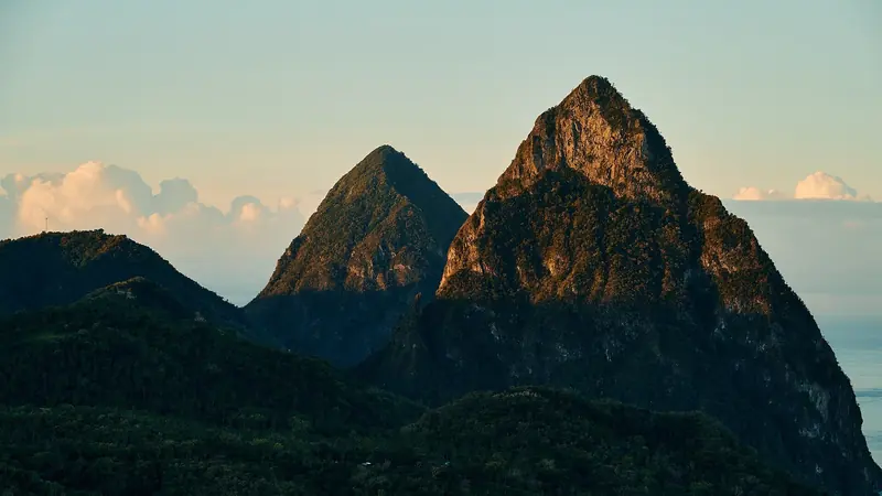
| Gros Piton | 798 m; Petit Piton: 743 m, linked by the Piton Mitan ridge |
| Reef covers about 60 percent of the Pitons Management Area's marine zone | |
| Soufriere Marine Management Association (SMMA) founded 1994, proclaimed a marine protected area in 1995 | |
| 5 designated yacht mooring zones in the SMMA: Anse Chastanet/Anse Mamin, Rachette Point, Soufriere Jetty, Malgretoute Beach, Beausejour | |
| SMMA Coral Conservation Permit | USD 20/night or USD 120/week (under 70 ft), USD 100/night (70-120 ft), USD 200/night (over 120 ft), USD 500/year for crewed charter |
| Anchoring is forbidden throughout the SMMA except on paid moorings | |
| Marigot Bay Marina | approximately 40 berths, official port of entry |
| Hurricane season | 1 June to 30 November, worst months historically September and October |
| Hurricane Allen (1980) | eye passed just south, 130 mph winds, 6 deaths, about USD 235 million damage |
| Hurricane Tomas (2010) | passed just south, 80 mph winds, 5 confirmed deaths, over USD 100 million damage |
| Hewanorra International (UVF), near Vieux Fort, to Rodney Bay: about 39 miles, roughly 1 to 1.5 hours by road | |
| George F. L. Charles Airport (SLU), Castries, to Rodney Bay: about 7 km, roughly 15 minutes | |
| Sulphur Springs volcano last erupted in the 1700s, marketed as the world's only drive-in volcano | |
| Diamond Falls sugar mill ruins on site date to 1765 | |
What does the island actually look like from the water
Saint Lucia runs about 27 miles north to south and 14 miles east to west, a rumpled spine of old volcanic peaks with Mount Gimie, at just over 950 meters, the highest point. The north end, around Gros Islet and Rodney Bay, is comparatively low and open, which is why the island's main yacht harbor ended up there rather than in the more sheltered but steeper south. The west coast, facing the calmer Caribbean Sea rather than the Atlantic swell, is where almost all cruising traffic runs: Rodney Bay, Castries, Marigot Bay, Anse la Raye, Canaries and finally Soufriere and the Pitons.
The east coast is Atlantic-facing, largely reef-fringed and undeveloped for yachting, so in practice a visiting boat never sees it. The west coast passage from Rodney Bay to Soufriere is a straightforward 20-odd nautical mile day sail in the lee of the island, with the wind acceleration zones off the deeper bays being the only real tactical issue before the Pitons themselves close in.
What is Rodney Bay Marina and what can it actually take
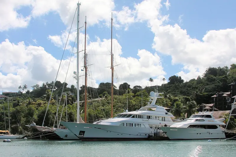
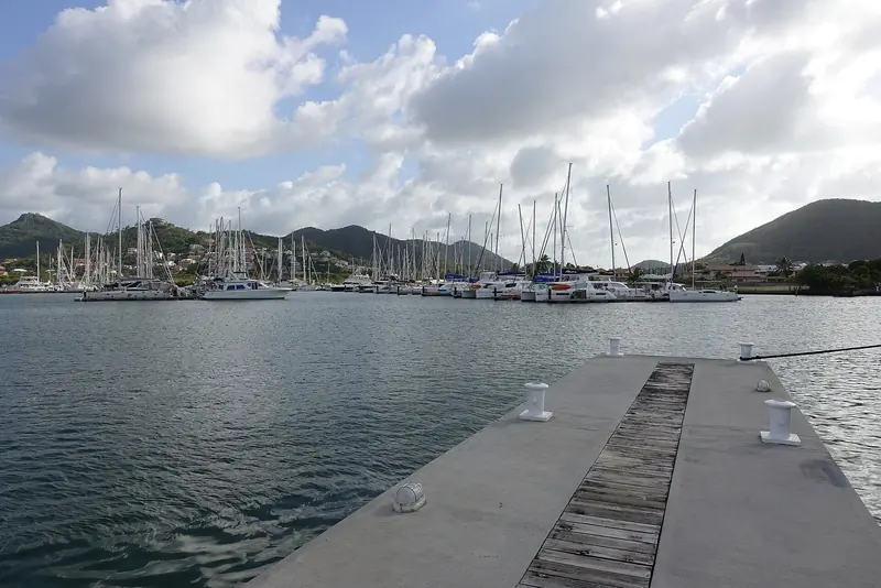
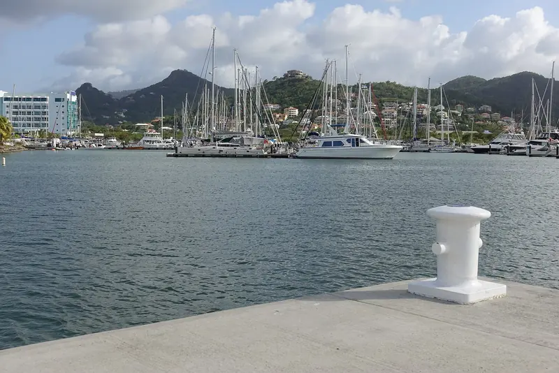
IGY Rodney Bay Marina, on the lagoon behind Reduit Beach and Gros Islet, is by far the busiest yacht facility in Saint Lucia. IGY's own figures put it at 253 slip berths plus 32 fixed megayacht docks, with the largest berths taking vessels up to 285 feet (86.8 meters), a maximum beam of 60 feet and a dockside draft of around 13 feet. A separate row of floating docks handles boats up to about 80 feet, which is the size range most private owners and charter boats actually fall into. The marina is also a full-service boatyard, with a 75-ton travel lift and a haul-out bay 28 feet wide, plus a fuel dock rated for high-pressure bunkering.
The operational detail that matters most for a foreign-flagged yacht: customs, immigration and port health are all inside the marina, so a boat can clear into the country without a taxi ride to a government office elsewhere on the island. Rodney Bay is also the base for the ARC and ARC+ transatlantic rallies each December, which is worth knowing if you are planning a winter arrival, since berths and services get heavily booked for a two to three week window around rally finish.
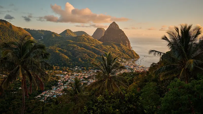
Anchoring is banned outright at the Pitons; every yacht there sits on a ranger-sold mooring, from USD 20 a night for a boat under 70 feet to USD 200 a night for anything over 120.
How much does a berth or a night on a mooring actually cost
Marina dockage in the Caribbean is quoted per foot per night and changes with season and promotions, so treat any figure as a planning number rather than a quote. Reported transient rates at Rodney Bay Marina for a 42-foot monohull have run in the USD 42 to 63 a night range, with catamarans typically priced at 1.5 to 2 times the monohull rate for the same length because of the beam they occupy. IGY has also run periodic discount promotions of up to 50 percent off published dockage, so the headline rate card is not always what a boat actually pays.
The Soufriere Marine Management Area, by contrast, publishes a flat permit schedule that is unusually transparent for the Caribbean. As of the current rate card, a boat up to 70 feet pays USD 20 for one night or USD 120 for a full week; a boat from 70 to 120 feet pays USD 100 a night; anything over 120 feet pays USD 200 a night; and crewed charter operators can buy an annual permit for USD 500. The money is earmarked for coral protection and ranger patrols rather than general government revenue, which is part of why the program has stayed funded since the 1990s.
Why are the Pitons a UNESCO site and what does that mean for anchoring
Gros Piton (798 meters) and Petit Piton (743 meters) are twin volcanic plugs joined by the Piton Mitan ridge, and together with the surrounding land and reef they form the 2,909-hectare Pitons Management Area, inscribed as a UNESCO World Heritage Site in 2004 for both scenic and geological value. The site includes a geothermal field of sulphurous fumaroles and hot springs, and coral reef covers close to 60 percent of its marine area, which is the direct reason anchoring is restricted here.
That restriction is enforced by the Soufriere Marine Management Association (SMMA), a non-profit co-management body set up in 1994 after years of conflict between fishers, dive operators and the growing charter fleet, and formally proclaimed a marine protected area in 1995. The SMMA divides its waters into marine reserves, priority fishing areas, recreational zones, multiple-use zones and five designated yacht mooring areas: between Anse Chastanet and Anse Mamin, at Rachette Point, off the Soufriere jetty, at Malgretoute Beach and in the Beausejour area. Anchoring is forbidden everywhere else in the SMMA, moorings are sold in person by uniformed SMMA rangers rather than online, and the association is explicit that its mooring tackle is not rated for tropical storm or hurricane conditions.
What is Marigot Bay and why do owners treat it differently
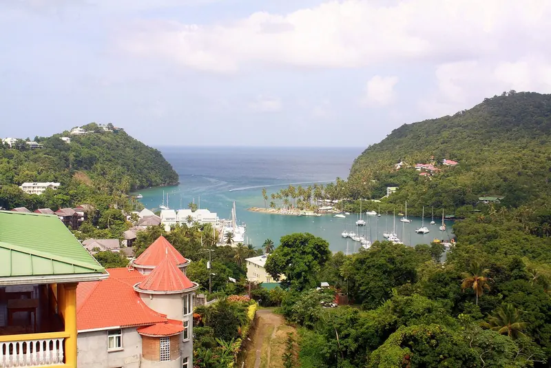
Marigot Bay sits about halfway down the west coast between Castries and Soufriere and is often called Saint Lucia's original yachting base: a Canadian schooner captain is credited with bringing the first serious cruising yacht in during the late 1950s, and the inner lagoon has been a working anchorage far longer than that. French and British naval forces are both said to have used the bay's narrow, mangrove-lined entrance to hide fleets from each other during the 18th-century contest for the island, and the same topography, steep hills wrapping a slender entrance channel, is what makes it a real hurricane hole today rather than just a pretty anchorage.
The inner bay now holds a small marina, Marigot Bay Marina, with around 40 berths and status as an official port of entry, alongside deep-water mooring and anchoring space in the outer harbor. It is a working example of the contrast that defines Saint Lucia cruising: Rodney Bay is the logistics and clearance hub, Soufriere and the Pitons are the scenic, permit-gated set piece, and Marigot is the place an owner actually leaves a boat unattended for a season or rides out a storm.
How does a foreign yacht clear in and out of Saint Lucia
Unlike Martinique or Guadeloupe to the north, Saint Lucia is a fully independent Commonwealth realm, a CARICOM and OECS member state that became independent from Britain on 22 February 1979, uses the East Caribbean dollar (pegged at EC$2.70 to USD 1) rather than the euro, and runs its own customs, immigration and port health regime. That means no simple French-style clearance kiosk: arriving vessels must clear in at one of Saint Lucia's four ports of entry, Rodney Bay Marina, Marigot Bay, Soufriere or Vieux Fort, each of which has customs, immigration and port health facilities.
Clearance must be completed within 24 hours of arrival, nobody may go ashore before it is granted, and offices generally operate Monday to Saturday 0800 to 1800 and Sunday and holidays 0800 to 1600 with a midday break, so a late-afternoon or Sunday-evening arrival can mean an overnight wait aboard. Skippers are advised to register in advance through the SailClear online pre-arrival system. One practical warning that recurs in cruiser guides: leaving a boat unattended at Vieux Fort while the skipper travels to clear immigration has been linked to daytime burglaries there, which is one reason many boats choose to clear at Rodney Bay or Marigot instead.
How real is the hurricane risk here
The Atlantic hurricane season runs officially from 1 June to 30 November, and Saint Lucia, at roughly 14 degrees north, sits well inside the zone that storms regularly track through, in sharp contrast to Aruba, Bonaire and Curacao, which sit outside the belt near the Venezuelan coast. September and October are historically the worst months for the wider Eastern Caribbean. Saint Lucia's own record includes Hurricane Edith in 1963, which killed 10 people with 90 mph winds, Hurricane Allen in 1980, whose eye passed just south of the island with 130 mph winds and caused six deaths and roughly USD 235 million in damage, and Hurricane Tomas in 2010, which passed just south with 80 mph winds, caused 5 confirmed deaths and over USD 100 million in damage.
Direct major-hurricane strikes are not annual events, closer to once every 10 to 15 years by the historical record, but near-misses and tropical storm effects (heavy rain, surge, wind) recur every two to three years on average. That is exactly why Marigot Bay's reputation as a genuine hurricane hole matters commercially, and why the SMMA is explicit that its Piton-area mooring tackle is not built to survive a named storm; owners keeping a boat in Saint Lucia through the season plan a haul-out or a run to Marigot or Grenada into the year, not just insurance paperwork.
How do you get guests onto a boat here
Hewanorra International Airport (UVF), near Vieux Fort at the island's southern tip, handles the long-haul jets from North America and Europe and is the airport almost every arriving charter guest will use. The catch is geography: UVF is about 39 miles from Rodney Bay by road, and the drive over the island's winding interior mountain roads takes roughly an hour to an hour and a half depending on traffic and route, longer by shared shuttle. For a boat based at Rodney Bay in the north, that transfer is the single biggest guest-logistics item to plan around, and it is also the reason some owners choose to have guests met at Hewanorra by boat via a short passage from Vieux Fort rather than by road.
George F. L. Charles Airport (SLU), by contrast, sits right on the water just north of Castries, about 7 km, roughly 15 minutes, from Rodney Bay, but it takes only regional turboprop and small-jet traffic (mainly from other Caribbean islands and a handful of connections), not long-haul international flights. In practice most guest itineraries combine a long-haul flight into UVF with the road transfer north, while owners doing island-hopping from Barbados, Martinique or St Vincent can use SLU directly into the Rodney Bay area.
What is there to do ashore beyond the anchorage
Sulphur Springs, just outside Soufriere, is marketed as the world's only drive-in volcano: a road leads directly into the collapsed crater of a geothermal field that last erupted in the 1700s and remains the island's youngest and only live volcanic center, with bubbling mud pools, sulfurous steam vents and mineral mud baths that guests can bathe in. Diamond Falls Botanical Gardens, less than a mile away, combines a mineral-stained waterfall, whose rock face changes color with the mineral content of the water running off the same volcanic system, with mineral baths and a rainforest trail past the ruins of a sugar mill dated to 1765.
Both sites sit within a 15-minute drive of Soufriere town and the Piton mooring field, making them the natural half-day excursion for guests while the boat sits on an SMMA buoy, and most local tour operators bundle the two attractions into a single trip. Castries itself, the capital near Rodney Bay, offers a working cruise-ship harbor, a produce and craft market, and access to the Pigeon Island National Landmark just north of the marina, but it is not a comparable draw to the Soufriere sites for a boat-based visit.
What is the honest downside of basing a boat here
Rodney Bay has a real and repeatedly documented theft problem targeting dinghies and outboard motors from yachts at anchor, with cruiser safety networks logging incidents through 2018 to 2020 including boardings that turned violent when owners interrupted thieves. Rodney Bay Marina has responded by running an 18-foot patrol boat through the anchorage from 6pm to 6am, and the standing advice from cruising guides is blunt: lift the dinghy and lock the outboard every night, at anchor or even alongside. It is not a reason to avoid the island, but it is a real operating cost (a locking cable and davits, or a marina berth instead of anchoring) that a first-time visitor should budget for.
The other honest limitation is that Saint Lucia's two signature draws, the IGY marina infrastructure at Rodney Bay and the Pitons and Soufriere Marine Management Area, sit at opposite ends of a mountainous island, roughly a full day's sail apart on the sheltered west coast. That is a manageable one-day passage but it means Saint Lucia rewards a boat that commits to at least a week, rather than a quick two or three day call, and it makes the island a poorer fit for an owner wanting to stage everything from a single base. Marina berth pricing is also not fully transparent: IGY publishes promotional rates rather than a stable public rate card, so an owner has to request a current quote rather than trust an old number.
What is not published here that you would want to know
IGY Marinas does not maintain a standing public rate card for Rodney Bay; figures circulating in cruiser forums and marina-comparison sites are secondhand and time-stamped inconsistently, so any per-foot number, including the ones above, should be confirmed directly with the marina before budgeting a season. Crime reporting is similarly informal: the Caribbean Safety and Security Net and individual cruiser blogs are the main sources for dinghy-theft and boarding incidents, and there is no single official police statistic series a reader can check against them.
On storms, national-level strike counts specific to Saint Lucia (as opposed to Atlantic-basin or Lesser Antilles aggregates) are not maintained in one public dataset; the named-storm history above is drawn from individual event records rather than a single official Saint Lucia hurricane log, so treat the once-per-10-to-15-years figure as a rough historical read rather than a modeled risk probability.
A terra, accessi e prenotazioni
| Getting there | Fly into Hewanorra International (UVF) near Vieux Fort for long-haul connections, then transfer about 1 to 1.5 hours by road to Rodney Bay; George F. L. Charles (SLU) at Castries is 15 minutes from Rodney Bay but regional flights only |
|---|---|
| Arriving by sea | Clear in within 24 hours at one of 4 ports of entry (Rodney Bay Marina, Marigot Bay, Soufriere, Vieux Fort); pre-register via SailClear; offices closed Sundays afternoons and for a midday break |
| Main yacht hub | IGY Rodney Bay Marina: 253 berths plus 32 megayacht docks, vessels to 285 ft, on-site customs/immigration, 75-ton travel lift |
| Pitons mooring rules | Anchoring banned throughout the Soufriere Marine Management Area; mandatory moorings in 5 designated zones, permits sold only by uniformed SMMA rangers |
| What it costs | SMMA mooring permit USD 20/night to USD 200/night by boat length; Rodney Bay Marina dockage reported around USD 42-63/night for a 42 ft monohull (confirm current rate directly) |
| Hurricane season | 1 June to 30 November, worst in September-October; Saint Lucia is inside the main hurricane belt, unlike the ABC islands; Marigot Bay is the recognized hurricane hole |
| Eating and ashore | Rodney Bay for marina-side restaurants and provisioning; Soufriere for Sulphur Springs drive-in volcano and Diamond Falls Botanical Gardens, both about 15 minutes from the Piton moorings |
| Known risk | Dinghy and outboard theft reported around the Rodney Bay anchorage; marina now runs a night patrol boat, cruisers advised to lock outboards nightly |
| What is not published | No standing public marina rate card, no single official crime statistic series for Rodney Bay, no dedicated Saint Lucia-specific hurricane-strike dataset |
Cosa riferiscono armatori ed equipaggi
Rodney Bay dinghy theft is a persistent, tracked problem
The Caribbean Safety and Security Net logged 19 crimes in a single reported year, with 15 concentrated in Rodney Bay, mostly dinghy and outboard theft, and cruiser accounts describe boardings that escalated to violence when owners intervened.
Caribbean Safety and Security NetMarigot Bay is treated as a real hurricane hole by insurers
Multiple marine insurance companies recognize Marigot Bay's steep, narrow-entrance inner lagoon as a genuine safe harbor for named storms, a distinction not extended to most Caribbean anchorages.
All At SeaSMMA moorings are explicitly not hurricane-rated
The Soufriere Marine Management Association states its own mooring systems, though maintained and marked with yellow tags, are unsuitable for tropical storm or hurricane conditions and disclaims liability for damage from defective gear.
Soufriere Marine Management AssociationRodney Bay Marina is the ARC and ARC+ finish port
IGY Rodney Bay Marina hosts the World Cruising Club's Atlantic Rally for Cruisers fleets each December, driving a seasonal surge in berth demand and marina services around the finish window.
IGY MarinasThe SMMA was built to end a real user conflict
Before 1994, fishers, dive operators and the growing yacht charter fleet were in open conflict over the same stretch of water off Soufriere; the co-management structure that resulted is credited with resolving it while formalizing yacht mooring zones.
Soufriere Marine Management Association
Cosa convince e cosa va valutato
Punti di forza
- Real marina infrastructureIGY Rodney Bay Marina has 253 berths, docks to 285 ft, a 75-ton travel lift and on-site customs and immigration, a genuine full-service base rather than a fuel dock with a few slips.
- A landmark that is actually managedThe Pitons Management Area has been a UNESCO World Heritage Site since 2004, and the Soufriere Marine Management Association has run a funded, ranger-enforced mooring system there since 1994.
- A genuine hurricane holeMarigot Bay's narrow, hill-locked entrance has sheltered vessels since at least the 18th century and is still recognized by marine insurers as a legitimate safe harbor.
- Transparent conservation feesThe SMMA publishes a flat, size-based permit schedule from USD 20 to USD 200 a night, unusually clear pricing for a Caribbean marine park.
- Compact, varied cruising groundA single roughly 20 nm day sail down the sheltered west coast connects a full-service marina, a historic hurricane-hole anchorage and a UNESCO dive and hiking destination.
Da valutare
- Dinghy and outboard theftDocumented incidents around the Rodney Bay anchorage, including cases that turned violent, have pushed the marina to run a nightly patrol boat from 6pm to 6am.
- Real hurricane exposureUnlike the ABC islands, Saint Lucia sits inside the main Atlantic hurricane belt and has taken direct or near-direct hits, including Hurricane Allen in 1980 and Hurricane Tomas in 2010.
- Long guest transfer from the main airportHewanorra International, used by nearly all long-haul flights, is about an hour to 90 minutes by winding mountain road from Rodney Bay.
- Non-EU clearance overheadAs an independent Commonwealth nation, Saint Lucia requires full customs and immigration clearance within 24 hours at a limited number of ports of entry, unlike the lighter formalities in nearby French islands.
- Opaque marina pricingIGY does not publish a stable public rate card for Rodney Bay, so berth costs circulating online are inconsistent secondhand figures rather than confirmed current rates.
A chi si rivolge: An owner or charterer who wants a proper marina base with full boatyard backup at one end of the trip and a genuine, permit-controlled natural landmark at the other, and who is willing to budget both a haul-out plan for hurricane season and a locking dinghy setup at Rodney Bay.