The Faroe Islands
| Region | North Atlantic, self-governing nation within the Kingdom of Denmark, outside the EU and outside Schengen |
|---|---|
| Scale | 18 islands (17 inhabited), 1,399 sq km land area |
| Population | approximately 56,365 (February 2026), about 22,700 in the greater Torshavn capital area, about 13,000 in Torshavn town itself |
| Core season | mid-May to end-August; June is the driest month, July has the warmest sea |
| Average summer wind | 4.5 to 4.9 m/s on paper, with far stronger katabatic gusts through fjords |
| Distance Lerwick (Shetland) to Torshavn: approximately 180 nautical miles | |
| Distance Scottish mainland (Oban route) to the Faroes: approximately 240 nautical miles per Rubicon 3's documented passage | |
| Distance Torshavn to Klaksvik | approximately 14 nautical miles direct |
| Distance Vestmanna to Mykines | approximately 30 nautical miles |
| Six ports of entry | Torshavn, Fuglafjordur, Klaksvik, Vagur, Tvoroyri, Vestmanna |
| Customs notice (TAKS) | at least 24 hours before crossing the 12-nautical-mile boundary, plus advance document submission |
| No entry or exit fees for foreign yachts | |
| A Schengen visa does not cover the Faroe Islands unless specifically endorsed for it | |
| Pilot reportedly mandatory for a vessel's first three visits within 12 months (superyacht/commercial context; unclear if enforced on small recreational yachts) | |
| Tidal currents up to 7 to 8 knots in island passages, notably Skopunarfjordur (Streymoy-Sandoy) and Vestmannasund | |
| Torshavn marina | approximately 15 to 20 stall berths plus 2 alongside, depths 3 to 5 metres |
| Klaksvik quay depth approximately 3.5 metres; visitor pontoon fee from 1 May 2024: 200 DKK/day (days 1-10), 500 DKK/day (day 11+), water and power included | |
| Grocery prices approximately 30% above Denmark, 25-35% above the US | |
| Olavsoka national festival | 28-29 July every year, Torshavn |
| First-ever animal-abuse charges brought over a 2024 grindadrap (pilot whale hunt), with an active international boycott campaign since 2023 | |
What this destination actually is, and is not
The Faroe Islands are a self-governing nation within the Kingdom of Denmark: 18 islands, 17 of them inhabited, 1,399 square kilometres of land, home to about 56,365 people as of February 2026, roughly 22,700 of them in the wider Torshavn capital area and about 13,000 in Torshavn town itself. There is no charter fleet based here, no fly-in-and-sail operation, and no resort marina culture of the kind found in the Mediterranean or the Caribbean. Cruisers who come here are almost always passage sailors using the islands as a stop between Scotland, Shetland, Iceland or Norway, not owners flying crew in for a relaxed week afloat.
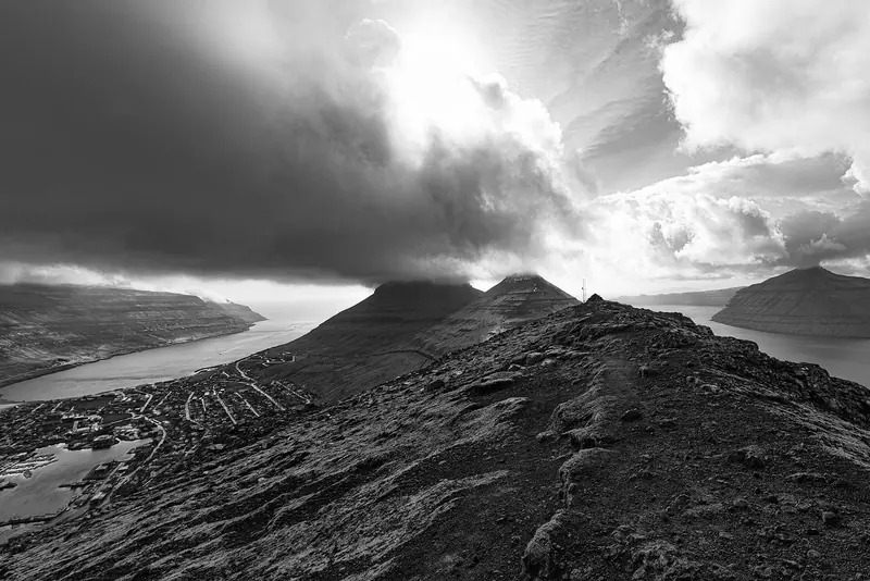
This is a raw, undeveloped cruising ground in the literal sense: sea cliffs, fjords and grass-roofed villages rather than beach clubs and tenders. That is the entire appeal and the entire limitation in one fact.
Getting there: a passage destination, not a charter destination
The standard approach is a direct hop from Lerwick in Shetland, cited at roughly 180 nautical miles. Rachael Sprot's Rubicon 3 expedition aboard the 60-foot cutter Hummingbird ran a longer approach from the Scottish mainland out of Oban, putting the open-water leg from the Scottish coast to the Faroes at approximately 240 nautical miles into fog and double-reefed conditions. Kila Zamana's steel expedition yacht Malaika arrived from the opposite direction, a near-2,000-mile, 18-day passage up from the Azores.
Iceland and Norway both sit within a multi-day leg in the other direction. There is no shortcut: this is a destination you sail to, not one you fly crew into for a week.
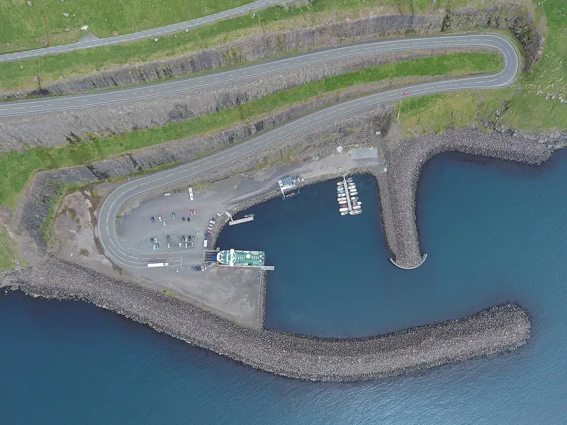
Eighteen islands, one real harbour, and a tidal current chart you had better trust more than the forecast.
Clearance: inside the Kingdom of Denmark, outside Schengen
There are six official ports of entry: Torshavn, Fuglafjordur, Klaksvik, Vagur, Tvoroyri and Vestmanna. Faroese Customs (TAKS) require notice at least 24 hours before a vessel crosses the 12-nautical-mile boundary, with documents submitted in advance; Noonsite separately records a requirement to notify again around 4 hours before arrival. The Harbour Master alerts Police and Customs, who normally board on arrival; there are no entry or exit fees. The important trap for anyone assuming the Schengen Area covers this leg: the Faroe Islands are not in the EU and not in Schengen, so a Schengen visa is not automatically valid here and must carry a specific endorsement covering the Faroe Islands.
For larger or crewed yachts, SuperyachtNews reports that a pilot is mandatory for a vessel's first three visits within any 12-month period, after which a pilot exemption certificate can be requested; whether this rule is applied in practice to ordinary recreational sailboats under a given length is not clearly published anywhere this research reached, and should be confirmed directly with a port agent before arrival.
The season: a narrow window that still does not guarantee good weather
The realistic sailing season runs roughly mid-May to the end of August. Average summer wind speed is modest on paper, around 4.5 to 4.9 metres per second, but that average hides the real story: cruisers who have actually been there describe persistent fog, dead calms followed by sudden strong wind, and katabatic gusts funnelling out of the fjords hard enough that Yachting Monthly's guide to the islands advises reefing even when the forecast looks benign.
Kila Zamana's crew on Malaika logged bone-chilling cold, frequent fog and rare usable sailing wind even in the height of summer, motoring far more than they sailed. Even the best-prepared crews cannot buy their way past this coast's weather; the window is real, but it is short and it still has bad days inside it.
The real hazard: tidal races between the islands
The single most serious navigational issue in the Faroes is not weather but tide. Narrow passages between the islands, most notably Skopunarfjordur between Streymoy and Sandoy and the Vestmannasund, generate currents reported at up to 7 to 8 knots, with overfalls and short, breaking seas where wind opposes tide. Two independent expedition accounts, Malaika and Hummingbird, both cite currents in this 7-to-8-knot range and both describe having to time departures around slack water rather than a fixed schedule.
Every cruiser account gathered here converges on the same tool: the RAK tidal-current app (rak.fo), which Yachting Monthly calls essential and which Kila Zamana's crew used to plan departures roughly an hour ahead of a tide change. There is no official, human-verified, real-time overlay beyond that app; a crew relying on it is relying on a model, not a live authority.
Torshavn: the only full-service harbour in the archipelago
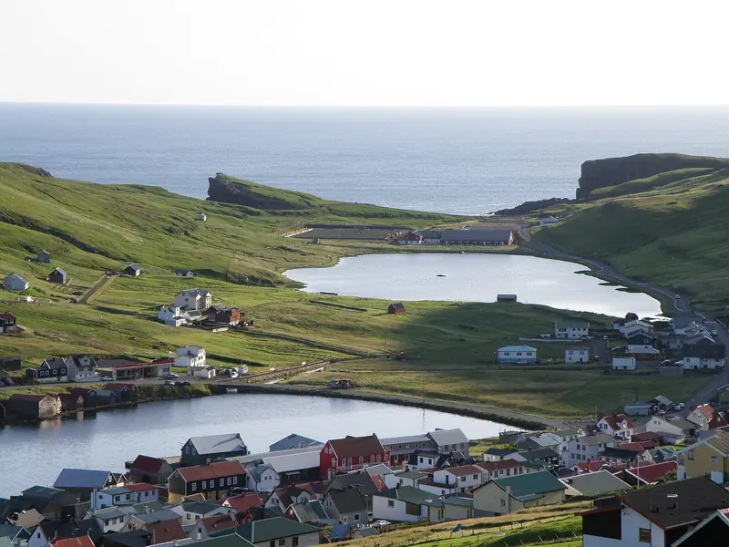
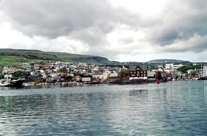
Torshavn's Vagsbotnur harbour is the sole location in the entire island chain with what a cruising yacht would call complete facilities: roughly 15 to 20 stall berths plus two alongside spots reserved for visitors, depths of 3 to 5 metres, free water and metered shore power at the yacht pier, marine diesel without a special card, showers and laundry through the local Marine Club, free wifi, and supermarkets (Bonus, Meny, FK Havn) plus a fresh-fish counter within walking distance. The Harbour Office is manned 24 hours (VHF channel 12, phone +298 311762) and there is no online booking system anywhere in the country; you call or hail on arrival.
That capacity is tiny relative to demand at the one moment the whole country converges on the capital: Olavsoka, the national festival, falls on 28 and 29 July every year in Torshavn and fills the town, harbour included. Arriving cruisers should plan around it rather than into it.
Klaksvik and the other ports of entry: workable, but basic and unpublished
Klaksvik, the second town, has an alongside quay depth of around 3.5 metres and, since 1 May 2024, a published visitor-pontoon tariff of 200 Danish kroner per day for days one through ten and 500 kroner per day from day eleven, water and power included. Diesel is available there without a special card, one of only two ports (with Torshavn) where that is true.
The other four ports of entry and smaller harbours such as Nolsoy, Fuglafjordur and Hestur are typically free or a small card charge for power, with a pontoon, occasionally a small bar or shop, and little else; Hestur, population 37, has essentially nothing beyond the pontoon itself.
Vestmanna and Mykines: the visual payoff, and why it is not guaranteed
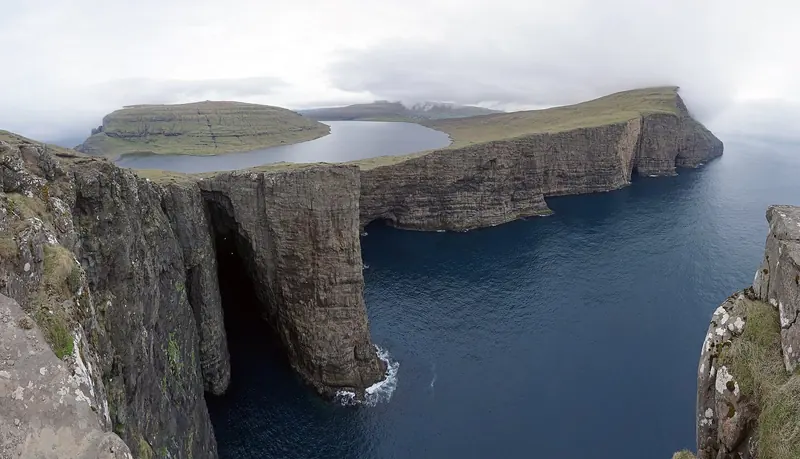
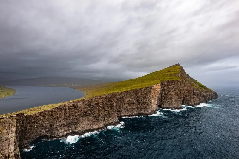
Vestmanna's sea cliffs, roughly 700 metres high in places, and the puffin colonies of Mykines are the reason most owners want to come here at all, and local tour operators run dedicated 1.5-to-2-hour cliff boat trips and longer 5-to-6-hour combined Vestmanna-and-Mykines day tours in season.
But landing at Mykines is routinely swell-dependent even for locals: Kila Zamana's Malaika attempted a stop there and had to abandon it because of southerly swell, and the same swell regularly cancels the island's own ferry and helicopter services. Treat a Mykines landing as a maybe, not a booking.
The grindadrap question
The Faroese pilot-whale hunt, grindadrap, is a live reputational issue an owner should know about before arriving, not discover on the water. Hunts happen unpredictably through the summer with no advance public schedule and can take place in full view of visiting boats and tourists; a widely reported 2024 hunt at Tjornuvik was witnessed by tourists, locals and Sea Shepherd volunteers alike.
That same 2024 hunt led to the first-ever animal-abuse charges brought over a grindadrap and a regional suspension, and an active international boycott campaign, Don't Visit Faroe, has been running since 2023. Kila Zamana's own account describes encountering a hunt in transit. This is not a reason to avoid the destination, but it is a genuine reputational and, for some owners, ethical consideration that a brochure would not volunteer.
Cost and provisioning: everything is imported, and priced like it
Grocery prices in the Faroe Islands run roughly 30 percent above already-expensive Denmark and 25 to 35 percent above the United States, because almost everything beyond fish, lamb and dairy is shipped in.
There is no meaningful yacht chandlery anywhere in the country: what repair capacity exists is shipyard capacity built for the fishing fleet, and a large or specialised yacht with a technical failure has nowhere local to turn beyond that. Torshavn's guest-berth rate is reported at 250 Danish kroner per night regardless of vessel size by a third-party harbour-data source, but no official, current tariff sheet is published by the harbour authority itself, unlike Klaksvik's clearly posted rate.
En tierra, accesos y reservas
| Getting there | No airport-based charter fleet or fly-in yacht base. Arrival is by sea only, typically as a passage stop: about 180nm from Lerwick, Shetland, or about 240nm from the Scottish mainland via the route Rubicon 3 has sailed. Vagar Airport (on a separate island, tunnel/road-linked) handles commercial flights for crew changes. |
|---|---|
| Arriving by sea | Clear in at one of six ports of entry (Torshavn, Fuglafjordur, Klaksvik, Vagur, Tvoroyri, Vestmanna). Notify TAKS customs at least 24 hours before crossing the 12nm boundary. Police normally board and clear on arrival. No entry or exit fee. Confirm your Schengen visa is specifically endorsed for the Faroe Islands before you leave. |
| How you actually reserve | There is no online berth-booking system anywhere in the country. Call or hail the Torshavn Harbour Office (+298 311762, VHF ch.12, manned 24 hours) or the relevant local harbour master on arrival; the same applies at Klaksvik and every smaller port. |
| What a berth costs | Torshavn is reported at 250 DKK/night regardless of size, per a third-party harbour-data aggregator, not an official published tariff. Klaksvik officially publishes 200 DKK/day for days 1-10 and 500 DKK/day from day 11 (from 1 May 2024), water and power included. Smaller harbours are typically free or a small card fee for power. |
| Power, water and fuel | Water is free at Torshavn's yacht pier; shore power is card-metered at most harbours. Marine diesel is available without a special card only at Torshavn and Klaksvik; other harbours need a local fuel card. No leisure-yacht chandlery exists; carry your own spares. |
| Eating and after dark within walking distance | Torshavn has cafes, restaurants and an Irish pub near the yacht pier plus Bonus, Meny and FK Havn supermarkets and a fresh-fish counter. Every other port of entry has at most a small shop, sometimes a bar (Nolsoy); Hestur has neither. |
| Fixed dates to plan around | Safe-weather window runs roughly mid-May to end-August. Olavsoka, the national festival, fills Torshavn and its small marina on 28-29 July. Grindadrap (pilot whale hunts) can happen unannounced anywhere in summer. |
| What is NOT published | No official current tariff sheet for Torshavn's guest berths from the harbour authority itself. No published count of annual foreign-yacht arrivals. No live, human-verified tidal-race forecast beyond the RAK current-prediction app. No clear public confirmation of whether the reported pilot requirement applies to small recreational sailboats or only commercial/superyacht traffic. |
Lo que cuentan armadores y tripulaciones
A one-time visual highlight, not a repeat cruising ground, and heavier on motoring than sailing
Sailed the 50ft steel expedition yacht Malaika on an anti-clockwise circuit (Torshavn, Klaksvik, Eidi, Vestmanna, Sorvagur, Hestur) and had to abandon a Mykines landing due to swell; called the Faroes one of the most visually beautiful cruising grounds in European waters but relatively small, requiring substantial motoring, and better suited to a single visit than regular return trips.
Kila Zamana, skipper of Malaika, quoted in Yachting WorldDense fog and 8-knot currents through unmarked passages, on a favourable but tense weather window
Skippered the 60ft cutter Hummingbird on a roughly 240nm passage from Oban, Scotland, into fog and strong tidal currents through rocky, unbuoyed channels; on committing to the crossing said, Maybe we should not look a gift horse in the mouth.
Rachael Sprot, founder/skipper, Rubicon 3, quoted in Cruising WorldThe tidal current app is treated as essential, not optional, after three seasons in the islands
Cruised the Faroes over three seasons aboard the Moody 44 Altor of Down, documenting the trip on her YouTube channel Adventure Now; calls the currents extremely dangerous at times and advises reefing sails even when the forecast looks benign, because of katabatic gusts off the hills.
Joanna Krasuska, owner of Altor of Down, profiled in Yachting MonthlyFive weeks working the islands slowly, with specific navigational warnings
Crossed from Orkney to Nolsoy in 36 hours and spent five weeks on an anti-clockwise circuit of the 18 islands; flagged the tidal race through Vestmannasund as needing careful timing and the jetty at Stora Dimun as a genuinely difficult landing.
Albert de Nijs and Claudia Koppeno, cruisers profiled in Yachting MonthlyA genuine gap in public reporting, disclosed rather than papered over
No forum thread, insurance claim, incident report or named account describing a grounding, dismasting or serious mechanical failure specific to a cruising yacht in Faroese waters turned up anywhere in this research. Given how few yachts visit each year and how small the online cruiser community discussing it is, that is a real and expected gap in this market, not evidence the waters are risk-free.
Absence noted across Cruisers Forum, Cruisers Wiki and general search; disclosed honestly rather than invented
Lo bueno y lo que conviene vigilar
Puntos fuertes
- Scenery with no real equivalent within reach of home watersVestmanna's roughly 700m sea cliffs and the puffin colonies of Mykines are described by every cruiser account gathered here as among the most dramatic coastal scenery reachable from UK or Scandinavian waters without an ocean crossing.
- A genuine expedition still inside two to three days of ScotlandAt roughly 180nm from Shetland, the Faroes sit within a short passage of the UK, unlike Svalbard or Greenland, while still delivering real subarctic isolation.
- Helpful, low-key harbour masters and a low-crime countryCruising World's crew aboard Hummingbird recorded a harbour master at Tvoroyri offering free showers and local knowledge unprompted; Noonsite records the islands as having almost no crime.
- Clear, fee-free clearance rulesSix defined ports of entry, a published 24-hour notice period, and no entry or exit fee, simpler on paper than several other Arctic-adjacent destinations.
- One genuinely complete base to fall back onTorshavn offers pontoons, fuel, free water, showers, laundry, wifi and full supermarkets within walking distance, plus a shipyard that can be pressed into service for basic repairs.
A tener en cuenta
- One town, fifteen to twenty berths, for eighteen islandsTorshavn's visitor capacity is tiny; the Olavsoka festival weekend alone can fill it, and there is no overflow marina anywhere else in the country.
- Real tidal danger backed by an app, not an authorityCurrents up to 7-8 knots in passages like Skopunarfjordur and Vestmannasund are managed by cruisers using the RAK phone app; there is no official real-time pilotage service behind it.
- No superyacht or dedicated leisure-yacht infrastructureRepair capacity and marine supplies serve the fishing fleet only; a large yacht or a boat needing a specialist part has nowhere local to turn.
- A short, unreliable weather windowEven peak-season crews (Malaika, Hummingbird) report persistent fog, dead calms followed by sudden strong wind, and days lost entirely to weather, in July and August.
- A live reputational tripwireThe grindadrap can occur in full view of visiting boats with no advance notice; a 2024 hunt brought the first-ever animal-abuse charges and sits inside an active international boycott campaign that any client-facing owner should be aware of before arriving.
Para quién es: An owner or expedition charter wanting a hard, weather-disciplined 2-to-6-week passage stop between Scotland, Shetland, Iceland or Norway with a capable crew and real tidal pilotage skills, not an owner expecting marina comfort, guaranteed itineraries or resort service.